A research project “Research of forest geobiocenosis” at the Foerstry and Game Management Research Institute (VÚHLM) in Zbraslav-Strnady included a partial task “Reserve research) under the supervision of Dr. Ing. Jaroslav Řehák, CSc. This task was carried out in the period 1953-1963 and concentrated mainly on the research of natural forests in forest reserves Mionší, Boubín and Žáková hora.
Mionší 1958 – Řehák’s PRP I. (segment)
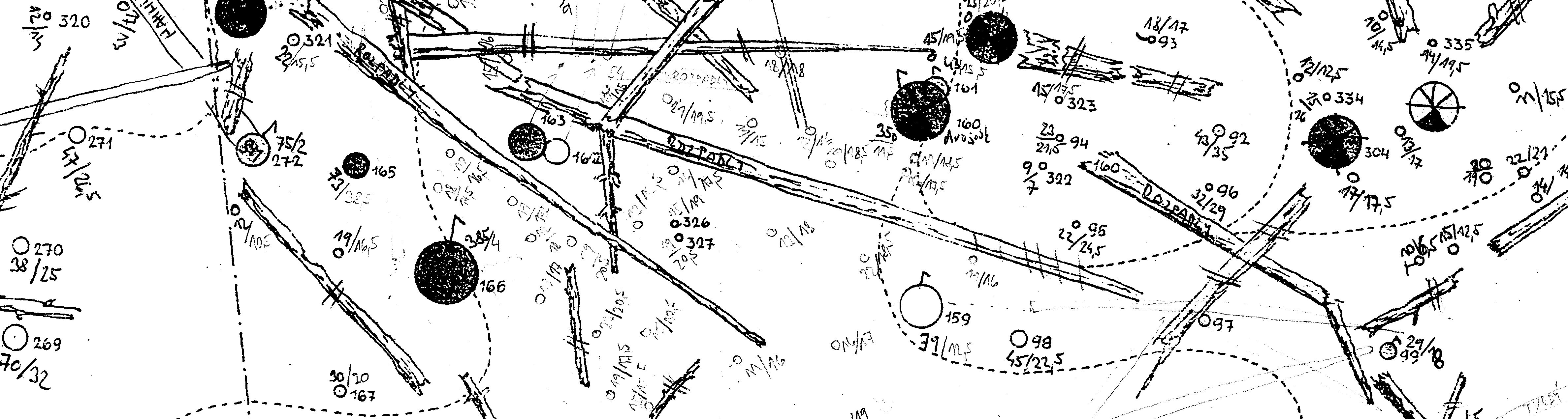
In 1953, workers from VÚHLM under the supervision of Dr. Ing. Jaroslav Řehák, CSc. established two PRP with the size 1 ha each in Mionší. They localized both standing and fallen trees with compass theodolite, conducted detailed dendrometric surveys and created maps of these plots. In 1958 survey was repeated on plot No. I while plot No. II was not surveyed due to imperceptible changes in the stand. Concurrently a total of 10 circular PRP with the area of 10 ares (i.e. a radius of 17.84 m) was established in a regular grid. These PRP served for detailed dendrometric surveys (similar to PRP I. and II.) and furthermore for detailed description of regeneration below the measured dimension of trees (d1.3 = 7 cm or up to 130 cm height) (ŘEHÁK 1963).
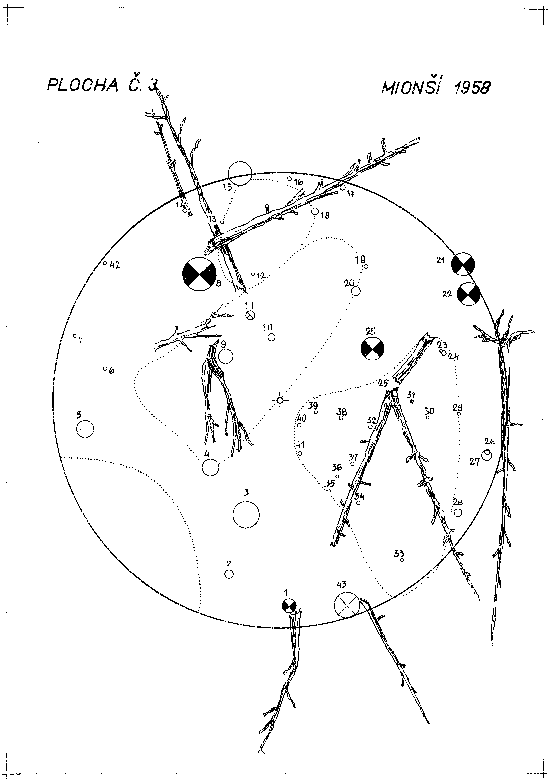
Mionší 1958 – Řehák’s PRP 3
In 1962 comparative plots to PRP were established directly in the reserve. These were three plots in stand units of “selection form” – A – 0.20 ha, B – 0.15 ha, C – 0.15 ha. Four plots (S, T, U, V) with the area of 0.20 ha were established in the adjacent managed stands and a detailed tree layer and dendrometric surveys were carried out on them. Third repeated survey on PRP I. and second repeated survey on PRP 1-10 were conducted in 1963. Two transects were established on PRP I. (ŘEHÁK 1963).
Žákova hora 1964 – Řehák’s PRP (segment)
Four 1 ha large PRP at different sites and in different growth stages were established in the Boubín virgin forest in 1954. Fist survey was carried out in the same year. In 1959 the surveys were repeated and all standing and fallen stems were localized (ŘEHÁK 1959, 1962, 1964). In addition, transects 100 x 10 m perpendicular to each other were marked for every two PRP. Localization of trees in transects was completed in 1960 and resulting maps were created (ŘEHÁK 1962, 1964). Between 1960 and 1961 all trees were callipered separately for each forest type. In 1961 Ing. V. Samko discovered one of border stones from John’s research plot No. V. and another was found in autumn of that year. One of two possible alternatives of the square plot with the area of 1 Lower Austrian are (0.5756 ha) was laid out. Trees in this plot were numbered and localized and a situational plan of their position in the field was created (ŘEHÁK 1962). A decade later (in 1964) surveys were repeated on 4 PRP and a second alternative of John’s plot No. V was laid out (ŘEHÁK 1964).
Řehák’s team repeated surveys on their PRP also in 1964, 1969 (outside of the research programme) and in 1972 on PRP I, II and IV. Surveys from 1972 were not evaluated. Later, repeated surveys on PRP I and II (1984) and III and IV (1989) were carried out under the supervision of Ing. Miroslav Vaněk, CSc. (VANĚK 1990). Another survey on all four PRP was repeated in 1996 in the form of diploma theses by students from the Department of Silviculture, Faculty of Forestry and Environment, Czech Agricultural University in Prague.
A PRP with the area of 0.75 ha was established under the supervision of Řehák’s collaborator Ing. Bozděch in the Žákova hora mountain. Surveys from this PRP were repeated in 1961, 1964, 1967 and 1971. In 1961 all trees on the plot were additionally callipered. Only a brief summary of the results was preserved from these surveys and complete reports are missing.