The primary criterion for disintegrating GIS database is the level of spatial resolution. Spatial objects (GeoObjects) in all three spatial levels (locality, inventory plot, tree) are interlinked by a pair of description attributes – locality code (PL_ID) and locality part (PL_ID_C). At the same time, these attributes act as a unique identifier. Spatial location of the GeoObjects is a natural implicit inter-level link in the GIS.
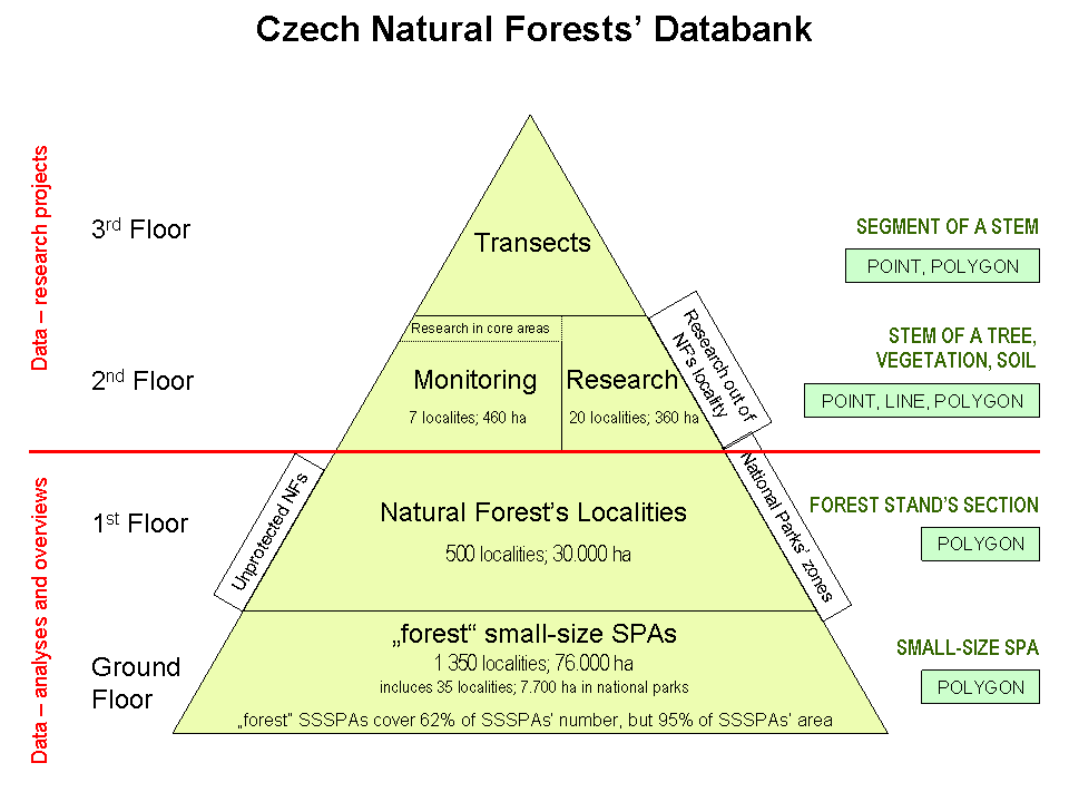
1. Locality of the natural forest
In comparison to the second and third level, this level displays areal characteristics, related either to the whole locality (PL) or its part (polygon PL) which is usually defined by the degree of naturalness of forest.
2. Inventory plot and core area at the locality of natural forest
Detail of the PL research at the second and third level is essentially identical. The difference lies in the degree of the PL research. The second level is associated with surveying individual trees and other ecosystem characteristics only in circular areas and core areas of a given size. Survey at the third level is conducted homogenously throughout the whole PL. PL is surveyed either at the second or at the third level but never simultaneously at both. Inventory plot is a circular plot with a radius ranging from 12.5 m to 14.9 m. It increases with a growth potential of the habitat and with a selected threshold thickness of the tree breast-height. Distance of inventory plots also varies. Distance between plot centres is most often 62.5 m / 88.5 m / 125 m. Coverage density of the PL by inventory plots then ranges between 1 plot per 0.4 ha / 1 plot per 0.8 ha / 1 plot per 1.4 ha.
Core area is either representative part of the surveyed locality PL or includes its most valuable part. It is usually a rectangle with the area of 1 ha, preferably 100 x 100 m square. Core area is not delimited in the field and is only defined virtually in a computer. A detailed definition of delimitating inventory plots and core areas, measurement methodology and information about metadata are indicated in Annex IV.
Integration of inventory plot and core
area into geographical part of the Databank must be preceded by the following
steps:
* Consolidating data from inventory plots and core area into a compact
structure, or rather adding new entities into the current file. This file
includes a set of thematic layers of GeoObjects which are surveyed at the
inventory plots and core area.
* Adding identification attributes PL_ID and
PL_ID_C to GeoObject databases in thematic layers of inventory plots and core
area.
* Incorporating values from identification attributes PL_IL and PL_ID_C
from the layer PL delimitation to the GeoObject databases of the given
inventory plot (core area).
* Changing value of attribute RESEARCH in the
layer PL delimitation.
3. Tree in the locality of natural forest
Detail of the research used in the survey of inventory plots is at the third level realized in the whole PL locality. More detailed survey is conducted in so called transects. This survey includes horizontal crown projection, height of all trees including onset of branching, taking the crown etc. Linking GeoObjects (layers) at the third level with respective PLs at the first level is preceded by incorporating identification fields (PL_ID and PL_ID_C) in primary databases. Then the GeoObject is horizontally linked with one of the layers selected on the basis of the thematic affiliation.